
Build an East Haven Previous-Residents Timeline
Start with the parcel, then choose a source that reaches the period you need. East Haven’s map, deed, directory, census, newspaper, permit, and probate records do not cover the same years or show the same relationship. A current owner is a starting point for the title chain. A directory entry is a dated address snapshot. An obituary or probate row can close a family-history trail, but neither one proves that every household member lived at the address.
| Source | Years or coverage | Where held | What it can show |
|---|---|---|---|
| Recorded maps | 1892-present listed | Town Clerk / SearchIQS | Lots, roads, subdivision and parcel context |
| Land records | Special 1970 and 1972-1975 references; strongest modern image/index run from 1977 | Town Clerk, SearchIQS, vault | Grantor, grantee, legal description, liens, mortgages |
| Assessor card | Current card with sale and permit history | Assessor / Property Record Cards | Owner tax record, building, values, sales, permit summary |
| City directories | Finding aids list 1929-1935 and regional runs through 1967 | Library, ACPL, FamilySearch | Address-to-name and name-to-address snapshots |
| East Haven News | Inspected 1939, 1943, 1946, 1947, 1951, 1952 issues | Hagaman and digital files | Names, notices, permits, reports, obituaries, local events |
| Census | Public schedules through the 72-year rule, currently through 1950 | NARA, Census, library databases | Household composition and historical geography |
| Probate | Public index January 5, 2011-present | District 36 / State Library | Estate, trust, fiduciary, and heir clues |
The date column is a research aid, not a promise that every volume is online. Ask Hagaman, the Historical Society, Town Clerk, or State Library about a missing reel, book, edition, or finding aid before treating a gap as a disappearance.
East Haven Previous Residents Start Here
The research package’s sample parcel at 60 Brown Road shows how the pieces fit. The assessor result identifies PRINZ BRIAN, unique ID M0015060, MBL 110 1125 004, residential use, 0.3500 acres, an R-3 zone, one building, and a volume/page reference. The sample card also carries a 2017 sale, a 1996 sale, building details, and 2017-2018 permit entries. These are property and tax records, so they anchor the land history rather than provide a complete list of past residents.
The East Haven assessor card result is the source for that parcel-level sample.
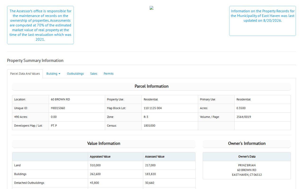
The card’s MBL, unique ID, volume/page, sale date, and street should travel together into the next search. If a later deed uses only a legal description, those keys help prove that the older record concerns the same land.
Do not read a mailing address as an occupant list. An owner can receive tax mail elsewhere, and a card can outlast a household change. The current card is the bridge into older records, not the endpoint of the history.
Note: The 60 Brown Road card demonstrates parcel joining, but it does not identify everyone who lived there.
Trace East Haven Previous Residents Through Deeds
Land records follow a transfer from one recorded party to another. Begin with the current grantee shown on the card or the most recent deed. Find that purchase in SearchIQS, note the seller, then search the seller as a grantee for the prior purchase. Repeat until the online index stops, the legal description changes, or a book must be checked in the Town Clerk vault.
- Write down the current owner name, street, MBL, unique ID, sale date, and volume/page.
- Search the grantee and deed date in the East Haven SearchIQS index.
- Read the seller, legal description, map or lot reference, and recorded book and page.
- Search the seller as the next grantee, using the legal description to avoid a same-name parcel.
- For early or missing images, call or visit the Town Clerk and request the book, page, map, or copy route.
The deed’s legal description beats a modern street number when the road, number, or neighborhood label has changed. Grantor means the party conveying an interest. Grantee means the party receiving it. A chain of title is the linked sequence of recorded transfers. A legal description identifies the land through boundaries, lot, map, or other recorded terms.
- Grantor
- The recorded party who conveys an interest in the property.
- Grantee
- The recorded party who receives that interest.
- Chain of title
- A linked sequence of recorded transfers for the same parcel.
- Legal description
- The recorded land identity, often more stable than a street number.
SearchIQS is a discovery and image route. The SearchIQS search help explains field behavior and filters, while the Town Clerk remains the custodian when dates conflict or an official copy is needed.
East Haven Previous Residents: Thin Index Years
East Haven’s early land-record coverage is described in more than one way. The Town Clerk page reports special online coverage for 1970 and December 29, 1975 forward. The SearchIQS availability sheet lists 1976 as index-only and index/images from January 1, 1977. SearchIQS town help says record-book images begin August 16, 1972. Maps are listed from January 1, 1892 and trade names from February 10, 1977. The conflict should stay visible in a house-history note.
When a search stops, move through the fallback chain: check the index again by grantor, grantee, document group, book/page, instrument number, and date; contact the Town Clerk; use the land-record vault, bound books, map set, or a copy request; then ask a library or historical researcher for a directory or newspaper bridge. A missing online image is not proof that the deed or map never existed.
The Town Clerk's fee schedule sets current copy and certification charges, while its official fraud-alert PDF explains same-name warnings. The land-record alert offers free recording notices. Neither replaces review of the recorded instrument.
Note: Confirm an old East Haven book and page with the Town Clerk before drawing a conclusion from competing portal coverage dates.
East Haven Previous Residents in Maps
GIS can place a property in a changing landscape. East Haven’s interactive map lists aerial layers from 1934, 1990, 2004, 2008, 2012, 2016, 2019, and 2023, along with original tax maps, parcels, zoning, flood, soil, water, and environmental layers. These layers can show a road, lot, shoreline, or building context that a deed paragraph does not make easy to picture.
Sanborn maps are a useful national map source for building footprints and use, but an East Haven-specific edition was not verified. The Library of Congress guide explains the map search by state, city, date, sheet, and notes; a New Haven 1886 sheet is not an East Haven substitute. Use the town’s verified tax maps and aerials first, and label a neighboring map as context rather than proof.
The Library of Congress Sanborn guide explains the metadata and search method.
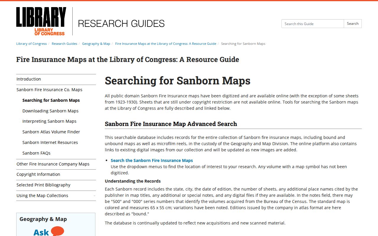
A map layer can reveal why a road or lot is hard to match, but the deed and Town Clerk map control the recorded parcel identity.
East Haven Previous Residents in Directories
Deeds name parties to a transfer. Directories can add a person who lived at or used an address without owning it. Finding aids list East Haven and regional runs from 1929-1935, 1934-35, 1937, 1940, 1942, 1950, 1959, 1963, 1965, and 1967, but the exact first East Haven-only edition, publisher sequence, reverse-directory run, and last local volume still need a library catalog check.
Hagaman’s digitized East Haven News issues from 1939 through the early 1950s can add names, notices, permits, meetings, and obituaries. FamilySearch and other library collections can provide an index lead, while the Historical Society may supply a place name or photograph. Use the scan, cite the date and page, and compare the address with the deed, map, census, or vital record.
The FamilySearch city and business directory collection is a discovery route for older name and address clues.
A directory line is a snapshot. It can suggest a former household, occupation marker, spouse, or address, but it does not replace a primary record or prove that every person in the home is listed.
Note: Directory and census years are comparison points, not continuous proof when a volume or household is missing.
East Haven Previous Residents Across Census Years
A household trail grows when neighboring years are compared. Pick a directory year, then check a public census schedule near that year, an East Haven News notice, a death or marriage route, a probate index, and a deed or map. The sources should agree on at least two anchors, such as a surname plus street, or a name plus spouse and neighborhood. Census geography may use a ward, enumeration district, or older place label, so keep the original geography in the note.
- Choose the earliest address line and record its edition, page, and exact spelling.
- Search the nearest public census year for the household and compare ages, names, and locality.
- Check East Haven News, an obituary, cemetery clue, or vital-record eligibility route for a dated event.
- Use Probate District 36 for an index case from January 5, 2011 forward, or ask the State Library about older material.
- Return to the deed and map chain to test whether the address remained the same parcel.
Probate index fields include district, case type, status, last name, first name, case number, and visible type context. They can point to an estate or trust, but they do not establish heirship or a current address without the permitted file.
East Haven Previous Residents and Permit Clues
Permit entries can explain a change in a structure between two directory years. The sample East Haven card records 2017-2018 work involving electrical service, heating, propane, stairs, chimney or fireplace, and interior work. Such entries show a construction event or application history. They do not identify everyone who occupied the building and should not be treated as a household list.
Start with the assessor card and then ask the Building Department or Planning and Zoning office about a particular permit or code record. East Haven lists Building at 203-468-3216 and Planning/Zoning at 203-468-3280. A current public code-case search was not confirmed, so the department’s retention, exemptions, and request route control. The town archive may also hold reports or permits in dated PDF material.
Property information, tax bills, deeds, maps, and permits should be dated separately. A new building description can reflect work on the same parcel, while a deed transfer changes the legal ownership trail.
East Haven Previous Residents and Boundary Labels
East Haven was incorporated in 1785 and ceded Fair Haven, Granniss Corners, and Morris Cove to New Haven in 1881. That history can put a New Haven term in an older directory, newspaper, cemetery reference, or family note. It does not mean every historical line belongs to the same modern municipality, so a researcher should compare the place name with a map, deed, parcel key, or library finding aid.
Postal labels add another layer. An East Haven situs can use 06513 while USPS displays New Haven. A directory may also abbreviate a neighborhood or use an exchange name. Search both the municipal and historical wording, then return to the MBL, unique ID, map or lot, and legal description to decide whether the records concern one address.
Note: The town boundary, postal city, neighborhood label, and legal parcel are separate facts that should remain separate in a history file.
East Haven Previous Residents: Lawful Limits
Earlier occupants can be a meaningful family-history or house-history question, but the records are partial. A deed may skip people who lived at a property. A directory may omit a household or carry an old spelling. An obituary is family-authored. A probate row is an index clue. A tax card can show an owner mailing address that never was the site of daily life. Describe the source and date instead of promising a complete list.
Connecticut confidentiality rules still apply to a historical trail. Vital records can restrict younger births and sensitive fields. Safe at Home and voter-privacy protections can hide addresses. Court, police, DMV, and utility records have separate limits. The right fallback is the custodian, library, archive, or historical society, not a guess based on a similar name.
Lawful house history. Use East Haven property, directory, and family records for personal research, genealogy, and place history. Do not use a past-residents search to stalk, harass, intimidate, or harm anyone.